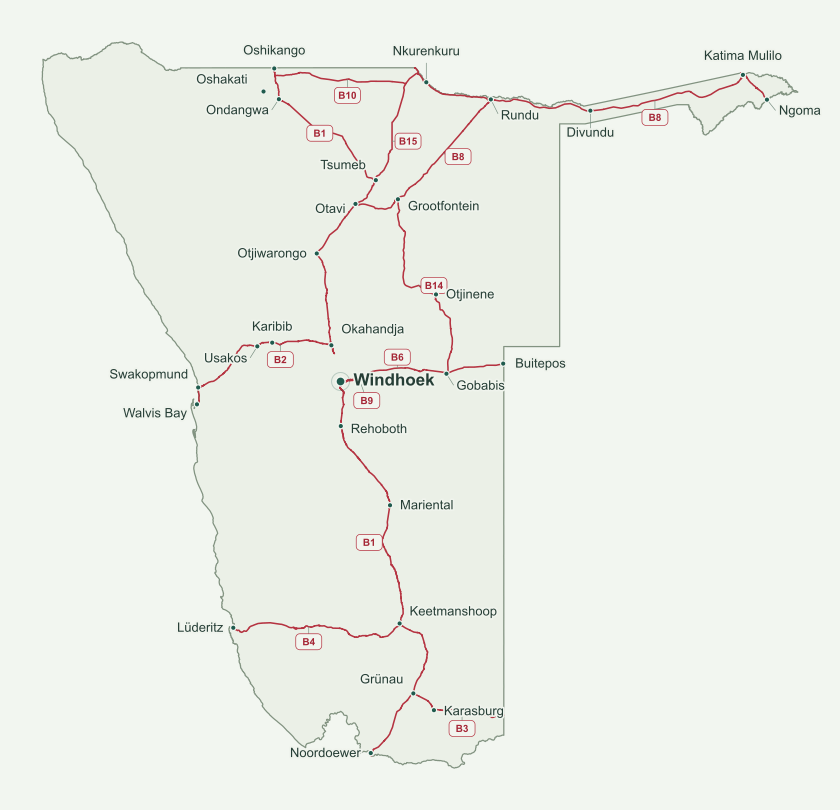
Courier delivery can be arranged wherever services reach. The roads and towns shown are geographical references, not confirmed delivery routes or collection points.
Sources, coordinate checks & map limitations
The road lines follow downloaded geographical coordinates; they are not drawn between town dots. Borders, coastline, roads and town markers use the same projection. The land border joins the coastline at shared source coordinates. Cross-border road segments stop at the national boundary.
All 28 displayed places were checked against a second coordinate source. OSM and GeoNames sometimes select different points within the same settlement; the Windhoek and Divundu differences are documented in the coordinate audit. Town markers are not street addresses.
- Only open road ways tagged with a B designation are shown. A1/A2, C- and D-roads, and roads tagged as under construction are excluded. This intentionally leaves gaps where a route has an A designation.
- Katwitwi approach: older road maps call this B11; the downloaded OSM data and Waze use B15. The existing alignment is shown once under the source’s B15 designation, without an invented additional road.
- B14 extension: sources describe work south of Gobabis towards Aminuis and Aranos. The downloaded B14-tagged geometry covers Gobabis–Grootfontein; an unconfirmed reclassification of the southern C-road is not shown as B14.
- This is a national-scale overview, not a navigation map or certified survey. Online source agreement cannot guarantee absolute accuracy or current road conditions.
Reference maps were consulted for comparison, not copied or embedded. Additional discrepancy checks: Divundu (Wikidata), Oshikango, Katwitwi approach (Waze), B14 extension background.